

The A57 Snake Pass will remain closed after recent heavy rainfall caused several sections of the road to slip.
The major route was closed on Monday (21 February) following damage caused by torrential rain as Storm Eunice and then Storm Franklin battered Derbyshire.
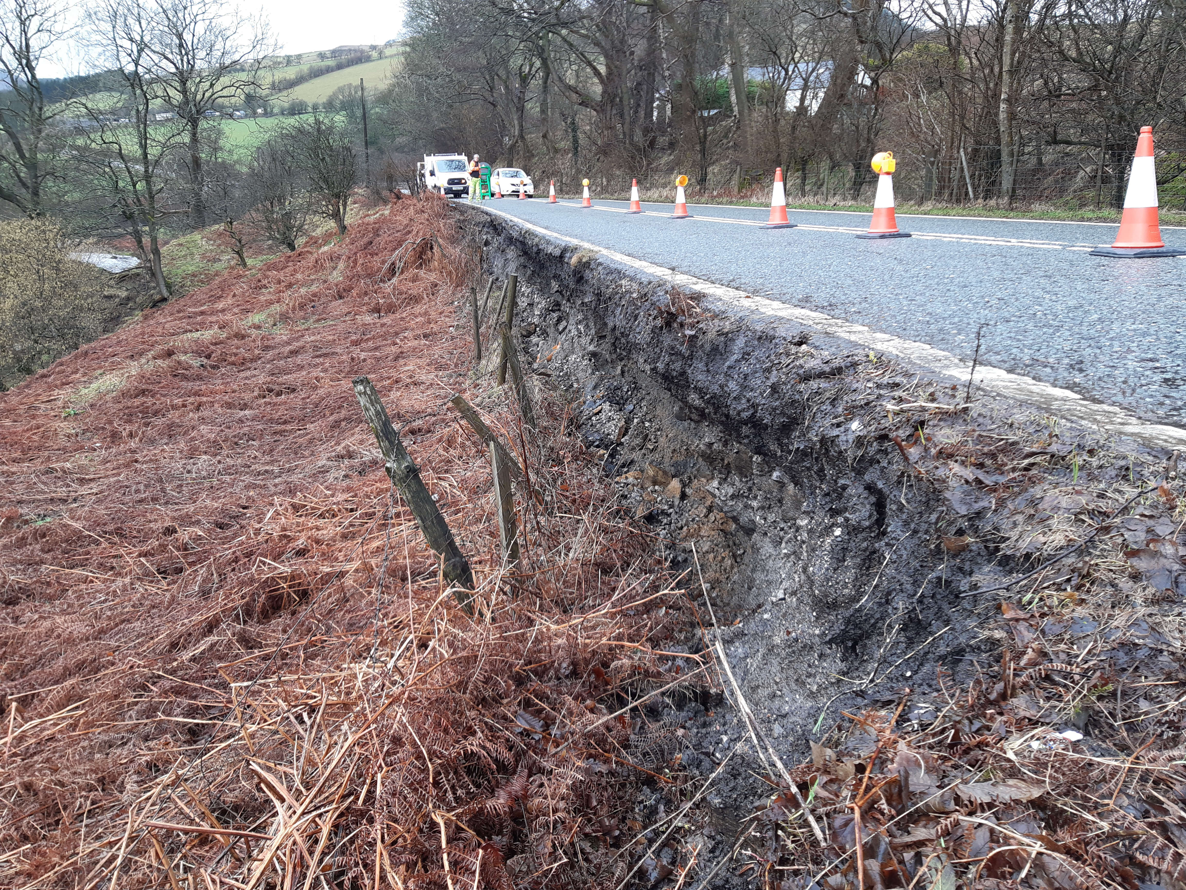
Inspectors found movement in three locations along a mile-long section of the road and a decision was made to close the road from Fairholmes car park at Ladybower Reservoir to Glossop to protect road users.
Derbyshire County Council say two of the areas of slippage were already being monitored carefully following previous movement but a third, more serious slip, has now appeared along the road where the verge has dropped by two metres.
The county council add that teams will continually monitor the situation but, as the ground is still moving, they are unable to come up with any final designs to repair the road until it has stabilised, which will be dependent on many factors including the weather.
At this stage, a one-month closure is in place however the authority says it is too early to say when the road will be able to re-open, following any necessary repairs due to the unstable nature of the ground.
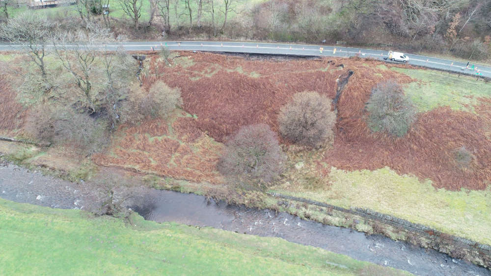
On Friday (25 February), Derbyshire County Council shared a new drone image of one of the landslips which has forced the closure of the Snake Pass. At the top of the image, a sizable gap can be seen between the hillside and the road which runs over the top of it.
Councillor Kewal Singh Athwal, DCC's Cabinet Member for Highways Assets and Transport, said: “I know this will be a huge inconvenience to everyone who uses the A57 regularly.
“However, with the ground underneath the road surface expected to continue to move, in the interests of everyone’s safety we simply cannot allow traffic to use the road.
“This is an evolving situation but please be assured we will continue to monitor the situation closely.
“Once the land movement has stopped we will assess what needs doing to repair the sections of road. However, once in a position to do this it will be a complicated piece of work.
“I’d like to thank everyone for their patience as we deal with the aftermath of this unprecedented weather which has affected not only Derbyshire but much of the country.”
The council say it is not known how long it will take the ground to stabilise before thorough assessments can be carried out.
Local access is being maintained for residents only.
Drivers are asked to follow the diversion route through Hathersage, Hope, Doveholes, Whaley Bridge, New Mills, Hayfield and Glossop and vice versa.
Images credit: Derbyshire County Council
Read more from the Glossop Chronicle
Click here for more of the latest news
Click here to read the latest edition of the paper online
Click here to find out where you can pick up a copy of the paper
 Labour’s Claire Ward voted in as first-ever East Midlands Mayor
 Burglary suspects bailed after Whaley Bridge farm shooting
 Teenager killed in suspected burglary at Whaley Bridge farm named
 Derbyshire voters go to the polls to elect a police commissioner and the first East Midlands Mayor


