

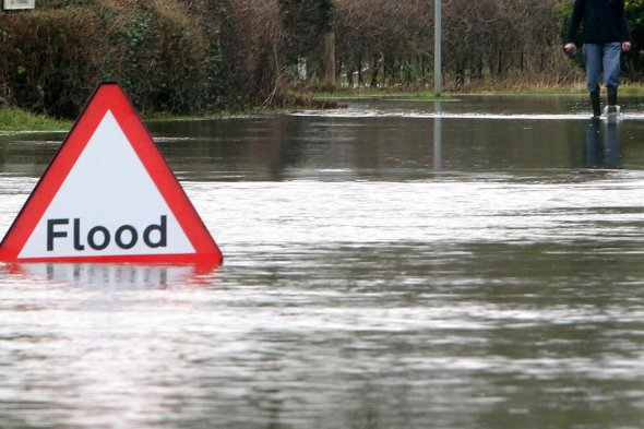
People are being urged to brace themselves for possible flooding this week, as the Met Office has issued amber and yellow warnings for rain across the region.
The Amber National Severe Weather Warning for what has now been named Storm Christoph includes our area.
It is valid from 6am on Tuesday morning until midnight on Wednesday night, with the potential for up to 120mm in parts of the southern Pennines and northern Peak District - including the High Peak.
Heavy rainfall combined with some snowmelt across the hills is likely to lead to some flooding.
A flood alert has been issued for the River Mersey Uplands catchment including Hyde, Ashton-under-Lyne, Denton, Stalybridge and Glossop for a prolonged period of heavy rain from Monday evening (18 January) to Wednesday 20 January, which will cause river levels to rise at the Woolley Bridge Gates river gauge and consequently flooding of property or roads and farmland is possible.
The Environment Agency added: "We expect river levels to remain high over the next couple of days and due to peak in the early hours of Wednesday 20th January. Our incident response staff are closely monitoring weather forecasts and river levels and will issue flood warnings if necessary. Please avoid using low lying footpaths near local watercourses, be aware of your surroundings, and keep up to date with the current situation."
The whole of Greater Manchester is covered by the amber weather warning. There is a 'medium risk' of flooding on Tuesday, Wednesday and Thursday - which means flooding is expected and people should be prepared.
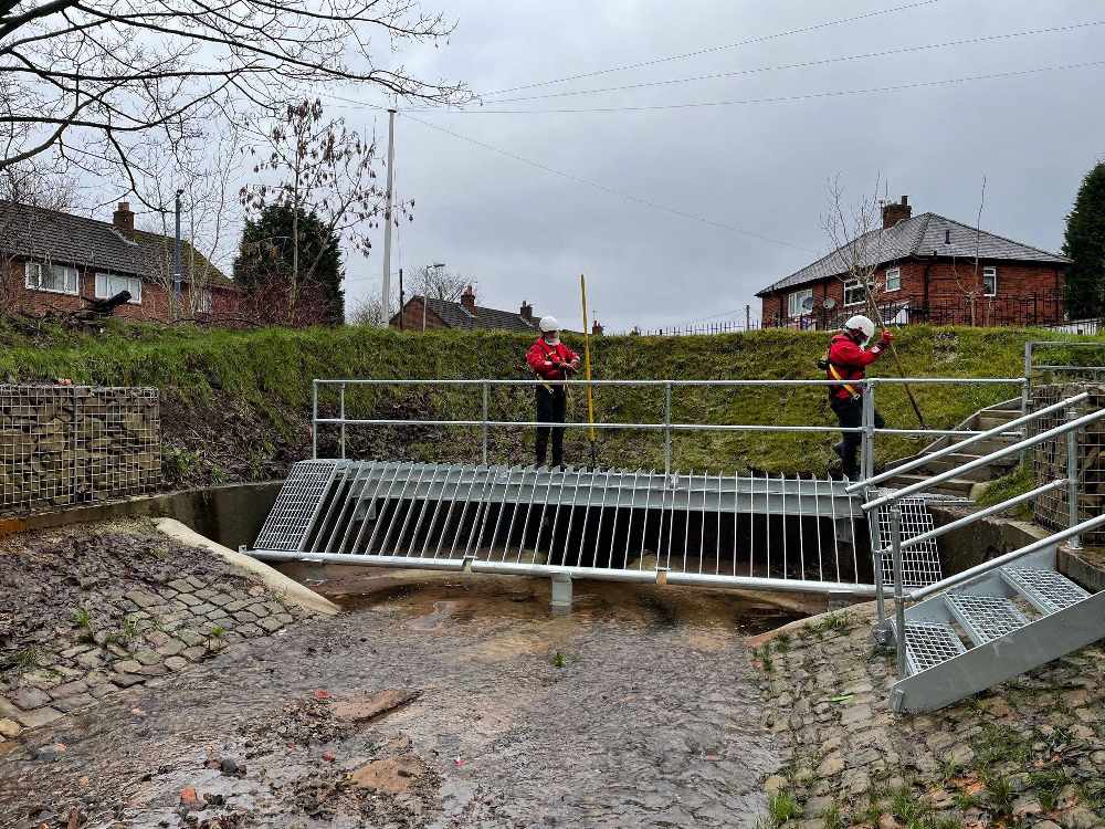
In Tameside, the Tame Valley, including parts of Mossley, Stalybridge and Ashton, is thought to be at particular risk – with the River Tame at risk of overflowing and large surface water run off expected, which could cause significant damage to property.
Tameside Council say it has teams out preparing for the flood risk, including clearing critical infrastructure such as culvert screens and gullies, especially in high risk areas.
Residents in areas prone to flooding are being urged to do their bit to prepare, including taking food, water, pets, furniture and vulnerable and sentimental items upstairs as well as moving cars to higher ground. More advice on what you can do to prepare for a flood and what to do in a flood can be found at https://www.tameside.gov.uk/floodresilience.
People are also urged to check their elderly and vulnerable neighbours are alerted and prepared. Motorists are advised to take care driving and never try to drive through flood water, with 80 per cent of flood deaths occurring in vehicles.
Chief Meteorologist at the Met Office, Neil Armstrong, said: “A wide area of rainfall will move across central parts of the UK on Monday evening and bring heavy rain for the following 36-48 hours. The rain will be heaviest across western facing hills, in particular parts of the southern Pennines and northern Peak District where we could see up to 120mm over the course of the warning period with 40-70mm of rain widely across the whole Amber area.
“Heavy rain will impact the whole of England and Wales by Wednesday with Yellow warnings for rain in force. By Thursday 100-150mm of rain could fall over high ground in Wales and Northern England. As well as rainfall, rapid snow melt will add to these accumulations, adding 5-10mm in the worst affected areas. These amounts of rainfall along with snow melt present a real threat of flooding, keep up to date with the latest Met Office forecast as well as flood warnings from the Environment Agency and Natural Resources Wales.”
⚠️⚠️ AMBER & YELLOW WARNINGS ISSUED ⚠️⚠️
— Met Office (@metoffice) January 17, 2021
Rain throughout Tuesday to Thursday across England and Wales
Latest info 👉 https://t.co/QwDLMfRBfs
Stay #WeatherAware ⚠️ pic.twitter.com/j6atOaWLdd
What to expect
Amid the deluge, the Met Office says some homes and businesses are likely to be flooded, causing damage to some buildings and structures.
Fast flowing or deep floodwater is likely, causing danger to life.
Delays and some cancellations to train and bus services are likely.
Spray and flooding will probably lead to difficult driving conditions and some road closures.
There is also a good chance that some communities will be cut off by flooded roads.
Power cuts and loss of other services is also likely for some homes and businesses.
As well as heavy rain, strong winds will add to the unsettled weather especially in higher and more exposed locations.
With milder air over much of the UK this week, the chance of snow has reduced in the early part of the week, with only some wintry showers forecast for parts of high ground in Scotland.
However colder air is never far away through the week and by Thursday there is a chance of further snowfall in parts of northern Britain as the area of low pressure pulls away into the North Sea.
Although Friday will be drier with more sunshine, the delayed response of some river systems means there is still a risk of flooding in some areas.
Into the weekend the feed of cold air from the north west is likely continue, with further wintry showers into the northwest.
You can keep up to date with the latest information here: https://www.metoffice.gov.uk/weather/warnings-and-advice/uk-warnings.
People can also sign up for free flood warnings, which will see you contacted either by phone, email or text message if your home or business is at risk of flooding, here: https://www.gov.uk/sign-up-for-flood-warnings
 Ashton restaurant threatens to expose dine and dashers after they scarper leaving £159 bill for food and cocktails
 Sound of music at The Vale as venue announces new gigs
 Mooch and natter in Mossley this May with the 2024 GM Walking Festival
 Hyde theatre receives £20K funding boost from the People's Postcode Lottery