
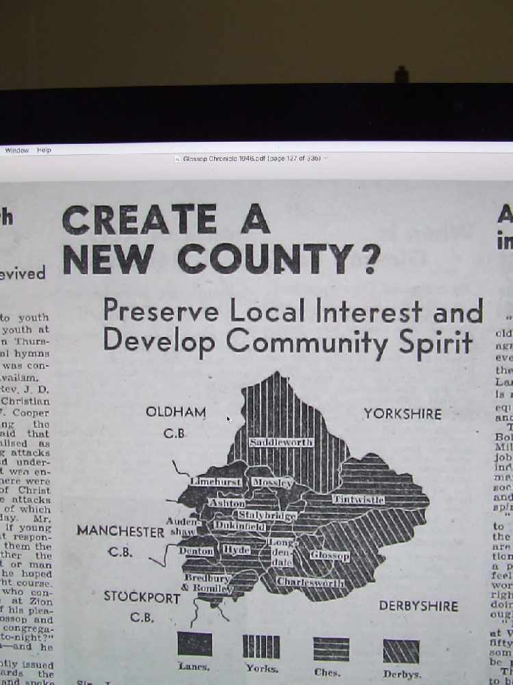
In 1946, the government was planning a nationwide network of county boroughs - and Glossop was being linked with towns and villages in Cheshire, Yorkshire, Lancashire and Yorkshire.
The Second World War was over and councils were in contention for a carve-up.
Twenty or so years on, local government reorganisation did kick in. Glossop Town Council became part of High Peak, joining New Mills, Chapel, Whaley Bridge and Buxton councils.
However in 1946 the time just wasn’t right.
Had it been, Glossop could have been in a county borough with all the places that now comprise Tameside MBC, plus Saddleworth, Bredbury and Romiley.
An amalgam of four counties, plus Derbyshire, with no real links except they shared boundaries and rubbed shoulders with each other.
It’s said that Glossop Town Council were in favour of the county lines disappearing as far as local government administration was concerned.
However the same could not be said for other Glossopdale councils who were totally opposed at what they saw as a loss of identity.
Glossop Council put the idea to them all and it is claimed Charlesworth were ‘hostile’.
So it never happened. But in the mid-1960s reforms did come in and the political map of England would never be the same again.
Main image:
ALL MAPPED OUT: The map of the proposed new county in 1946.
Read more from the Glossop Chronicle
Click here for more of the latest news
Click here to read the latest edition of the paper online
Click here to find out where you can pick up a copy of the paper
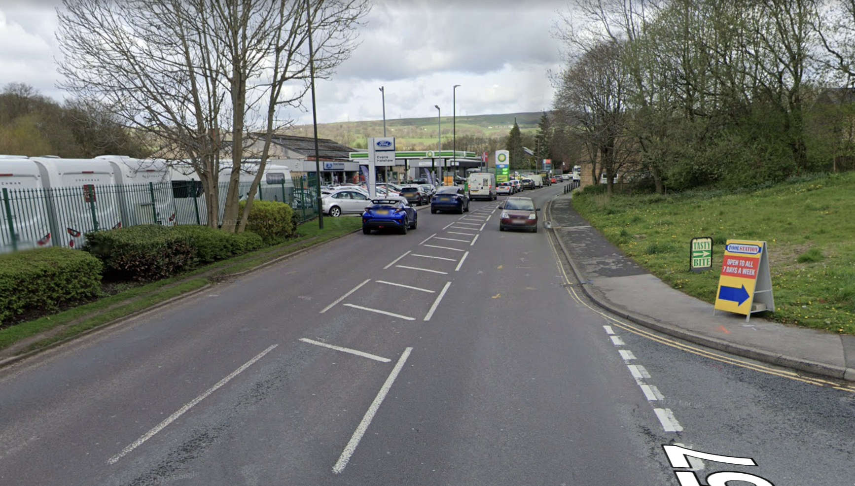 Temporary road closure in Glossop
 Adventure-loving Naimah wins top Rotary Club award
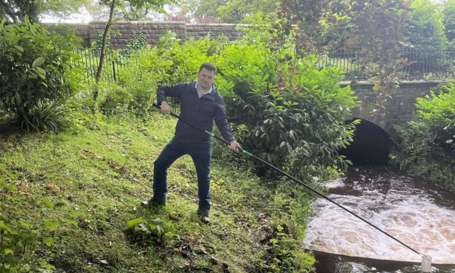 Local MP invites residents to join him at Severn Trent River Rangers
 Glossop Carnival back this summer in Manor Park


